Top Stories
Arctic Blast to Bring Dangerous Cold, Snow Next Week
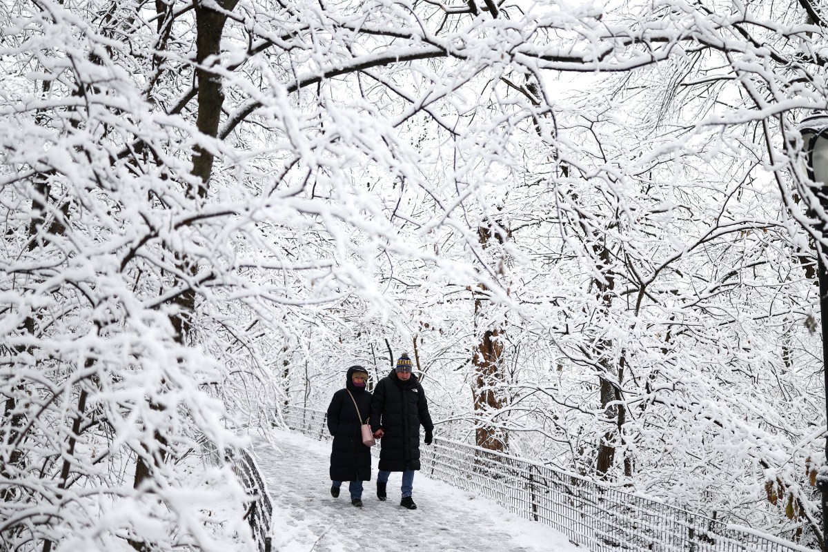
UPDATE: An Arctic blast is set to plunge dangerously cold temperatures across the Midwest and Northeast next week, just as we transition into 2026. Forecasters warn that a pair of powerful cold fronts will roll in, leading to subzero conditions and heavy snowfall.
According to Renee Duff, a senior meteorologist at AccuWeather, “The lake-effect snow machine will be flipped on,” bringing significant snowfall to the region. The National Weather Service (NWS) has issued alerts indicating that from January 1 to 5, 2026, areas including Pennsylvania, Ohio, and the Great Lakes states of Wisconsin, Illinois, Indiana, and Minnesota will experience below-average temperatures.
This drastic weather change follows what was recorded as the warmest Christmas in U.S. history, with many experiencing unusually mild temperatures. However, the festive season has been harsh for others, as a prior winter storm brought heavy snow and ice to parts of the Great Lakes and Northeast.
As of early Saturday, over 650 flights within, into, or out of the U.S. were delayed, with at least 600 cancellations, according to FlightAware. New York’s major airports have been particularly impacted, alongside further disruptions reported in Boston. The chaos follows an already tumultuous Friday, which saw more than 8,500 delays and 1,700 cancellations.
In Michigan, ice accumulation has left over 30,000 homes and businesses without power as trees and power lines succumb to the weight, per data from poweroutage.us.
Weather warnings for extreme cold and storms are currently in effect across much of the northern U.S. In Montana, extreme cold warnings are issued along the Canada-U.S. border, with “dangerously low wind chills” of minus 40 degrees Fahrenheit expected in some areas. The NWS cautions that such severe temperatures can cause frostbite on exposed skin in as little as 10 minutes.
Residents are urged to “dress in layers including a hat, face mask, and gloves if you must go outside,” according to forecasters. In the Great Lakes region, frigid temperatures are expected to persist over the weekend.
Numerous winter storm watches are active in Wisconsin and Michigan, particularly near the lakes. In New York, Pennsylvania, Vermont, Rhode Island, and Connecticut, multiple winter storm warnings and weather advisories are currently in place.
The NWS reports, “Much of central and southern New England will wake up with 4 to 8+ inches of snow,” as a low-pressure system moves eastward against a Canadian high-pressure system supplying cold air. This storm is anticipated to intensify rapidly, moving out into the Atlantic before the weekend concludes, with colder-than-normal temperatures expected to linger.
As this Arctic blast unfolds, residents are advised to stay updated on weather alerts and prepare for hazardous conditions. The impact of this severe cold could be significant, affecting travel and daily life as we start the new year.
Stay tuned for more updates on this developing story, and prepare for a bitter start to 2026.

Analysts Highlight Manulife Financial as a Leading Investment Choice

Vauban Revamped: New Abilities and Skin Launch on February 11

Understanding Chronic Venous Insufficiency: Symptoms and Solutions

Fayetteville Storage Facility Fire Erupts, Ramsey Street Closed

Grab the Wyze Cam OG Now at 50% Off for Enhanced Home Security

Big Bear’s Bald Eagles Capture Hearts as Social Media Sensations
Water Molecules Transform Prolinol Catalyst Structure, Study Finds

New York Times Bestsellers: Top Titles Revealed for January 24

Twin Capital Management Reduces Stake in Public Storage by Over 54%

ALMA Discovers Companion Orbiting Giant Red Star π 1 Gruis

Doctoral Candidate Trivanni Yadav Advances Battery Research at UTulsa

New ‘Star Trek: Voyager’ Game Demo Released, Players Test Limits

Global Air Forces Ranked by Annual Defense Budgets in 2025

Mass Production of F-35 Fighter Jet Drives Down Costs

NASCAR Faces Fan Backlash as Steve Phelps’ Texts Surface

Gold Investment Surge: Top Mutual Funds and ETF Alternatives

DirecTV to Launch AI-Driven Ads with User Likenesses in 2026

SEVENTEEN’s Mingyu Faces Backlash Over Alcohol Incident at Concert
-
 Science3 months ago
ALMA Discovers Companion Orbiting Giant Red Star π 1 Gruis
-
 Science3 months ago
Doctoral Candidate Trivanni Yadav Advances Battery Research at UTulsa
-
 Top Stories4 months ago
New ‘Star Trek: Voyager’ Game Demo Released, Players Test Limits
-
 World4 months ago
Global Air Forces Ranked by Annual Defense Budgets in 2025
-
 World4 months ago
Mass Production of F-35 Fighter Jet Drives Down Costs
-
 Sports3 months ago
NASCAR Faces Fan Backlash as Steve Phelps’ Texts Surface
-
 Business4 months ago
Gold Investment Surge: Top Mutual Funds and ETF Alternatives
-
 Top Stories4 months ago
DirecTV to Launch AI-Driven Ads with User Likenesses in 2026
-
 Politics4 months ago
SEVENTEEN’s Mingyu Faces Backlash Over Alcohol Incident at Concert
-

 Science4 months ago
Time Crystals Revolutionize Quantum Computing Potential
-

 Entertainment4 months ago
Freeport Art Gallery Transforms Waste into Creative Masterpieces
-

 Science4 months ago
Remembering David E. Brest: A Life Dedicated to Nature and Family